The Tennessee River is unique in many ways.
Its watershed drains from seven states, starting in the Appalachia Mountains to the east.
Interestingly, even though the waters of the Tennessee flows southwest for much of its length, it flows northward more than any river in North America except the Mackenzie River that flows to Hudson Bay.

It is thought that the Tennessee originally flowed to the Mobile Alabama area directly into the Gulf of Mexico, but in the beginning of the Paleozoic period, it was rerouted to more of its current course by natural erosion with sediment from the Appalachia Mountains and followed the path it follows today to the Ohio River.
The river’s resources made it a prime location for early Native American settlement starting in the Paleolithic Period around 8,000 BCE and earlier.
The Tennessee River was a major source of food and a trade route for Pre-Columbian Americans.
The river’s course from mountainous land to wide, flat bottomlands created both beautiful navigable waterways and treacherous shoals that stymied travel.
The Tennessee River’s current name is derived from the Cherokee town, Tanasi, which was located on the Tennessee side of the Appalachian Mountains. The river was at one time called the Cherokee River, among other names.
The Native American tribes called the Cherokees, Chickasaws,Choctaws, Chickamauga, and Creeks dwelt at various points along the river before the Europeans recognized the importance of the river.
Native Americans started becoming displaced in the eighteenth century as the white man moved in.
An interesting history of prehistoric Tennessee can be found here at this hyperlink.
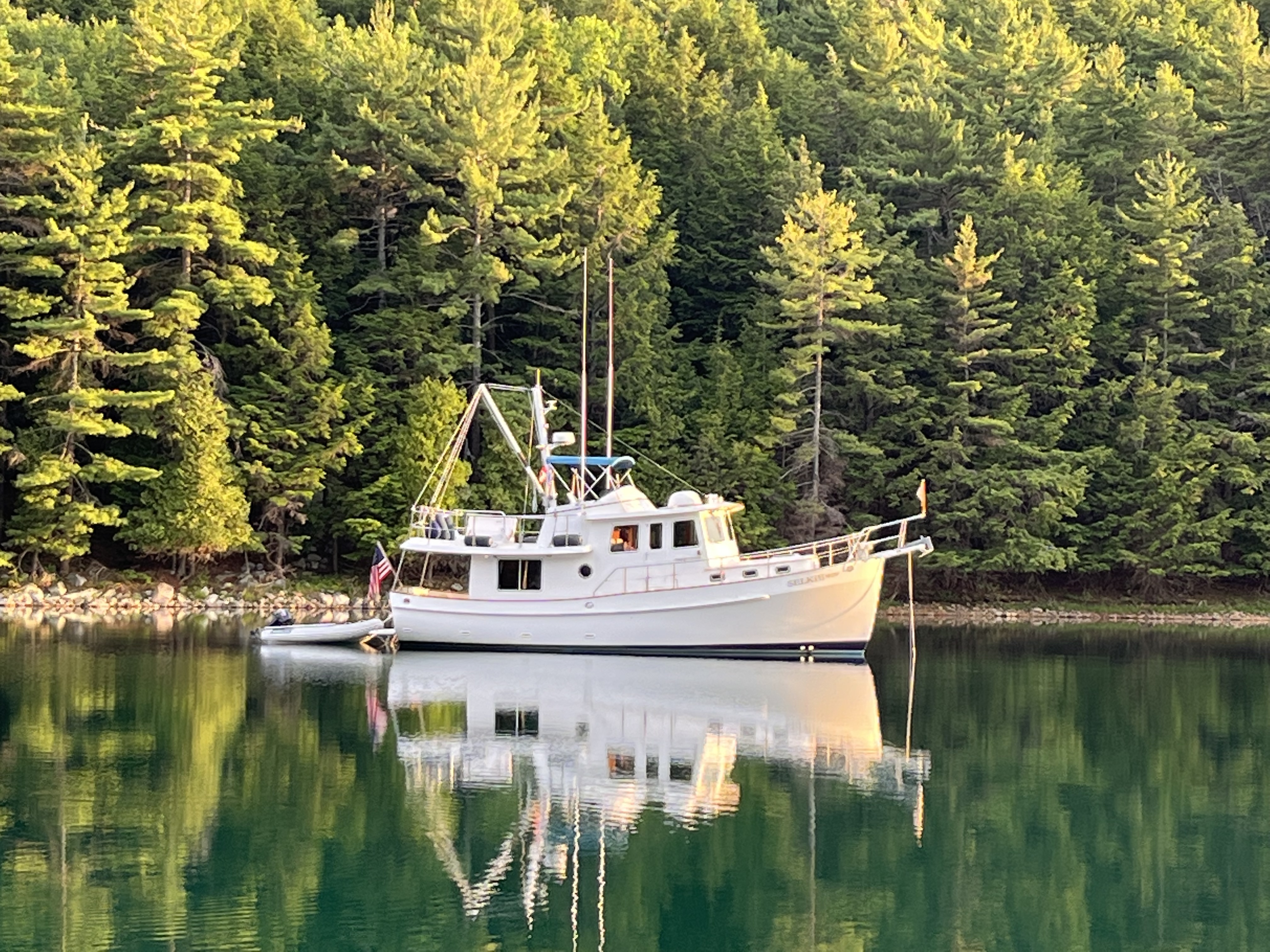
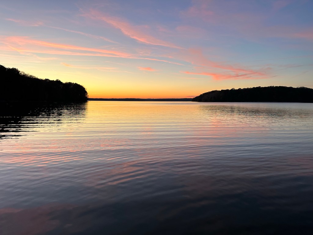
As I said in the last blog post, Kentucky Lake was formed when the Army Corps of Engineers dammed the Tennessee in the early 1940’s.
Kentucky Lake has a lot of anchorages to choose from.
Panther Bay provided a very nice evening for us.
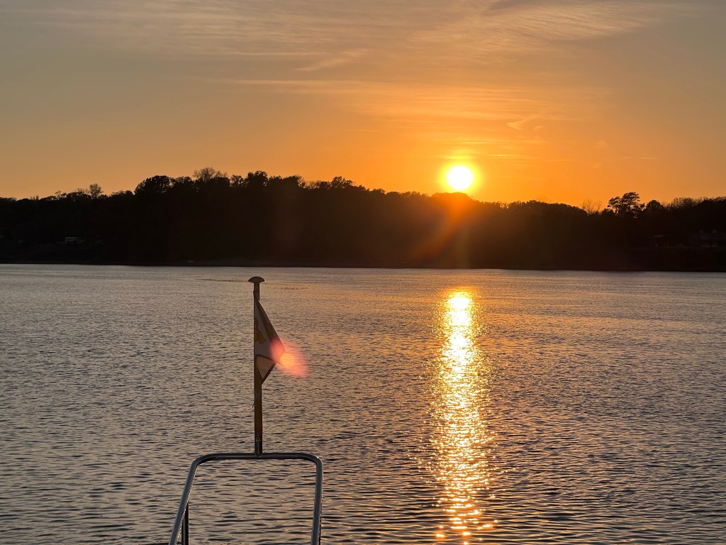
The next morning, we pulled up anchor and wandered south on Kentucky Lake to where the Tennessee River flowed into the lake.
The sides of the lake grew closer as we came to the head of the lake.
The rolling hills with the deciduous trees, some in fall color, some still green and some losing their leaves entirely were starting to be interspersed with cypress and other more southern species of trees like hickory and white oak along the riverbank.
The same went for the wildlife. We saw blue, white and lousiana herons, more white pelicans, more eagles, and lots of fish, jumping as we went up the river.

I was surprised how rural the countryside is around Kentucky Lake and the Tennessee.
We would travel for miles and often would not see anybody. It is the fall, but I would have expected more boaters.
We entered the Tennessee River.
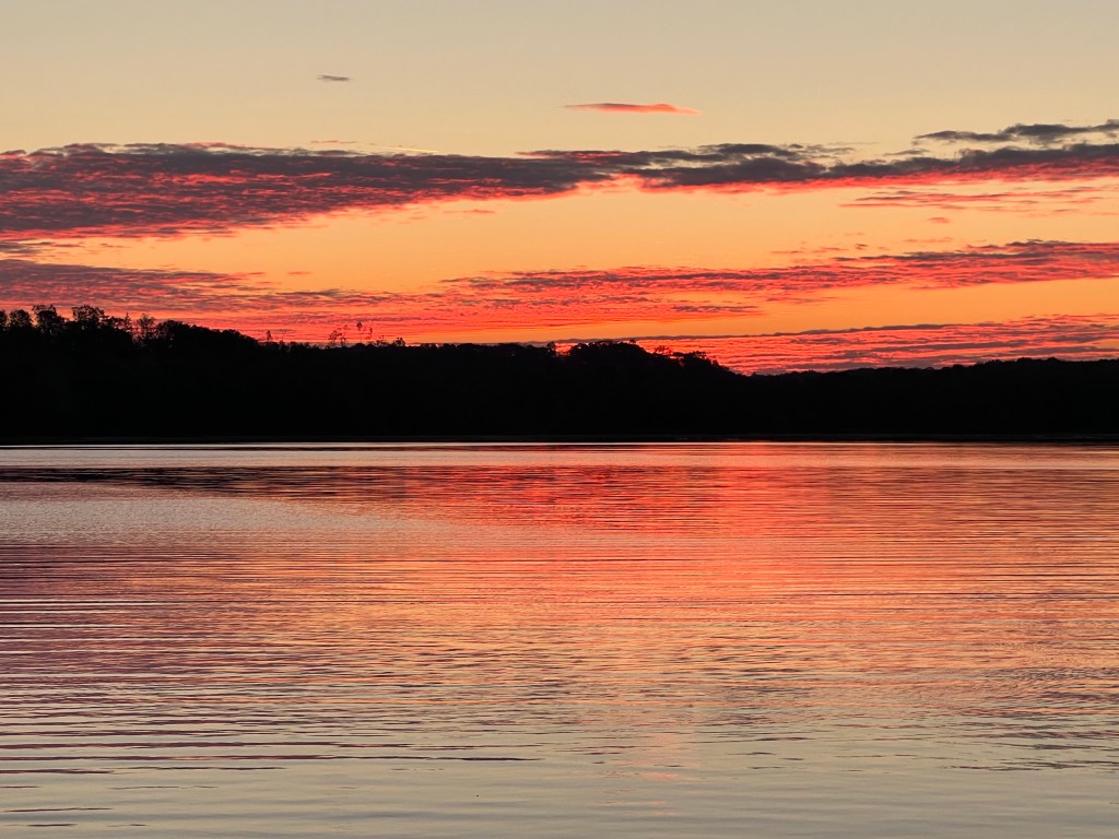
The further up the Tennessee we went, the more beautiful the scenery became. It’s like a landscape painting that you might see in the Louvre.
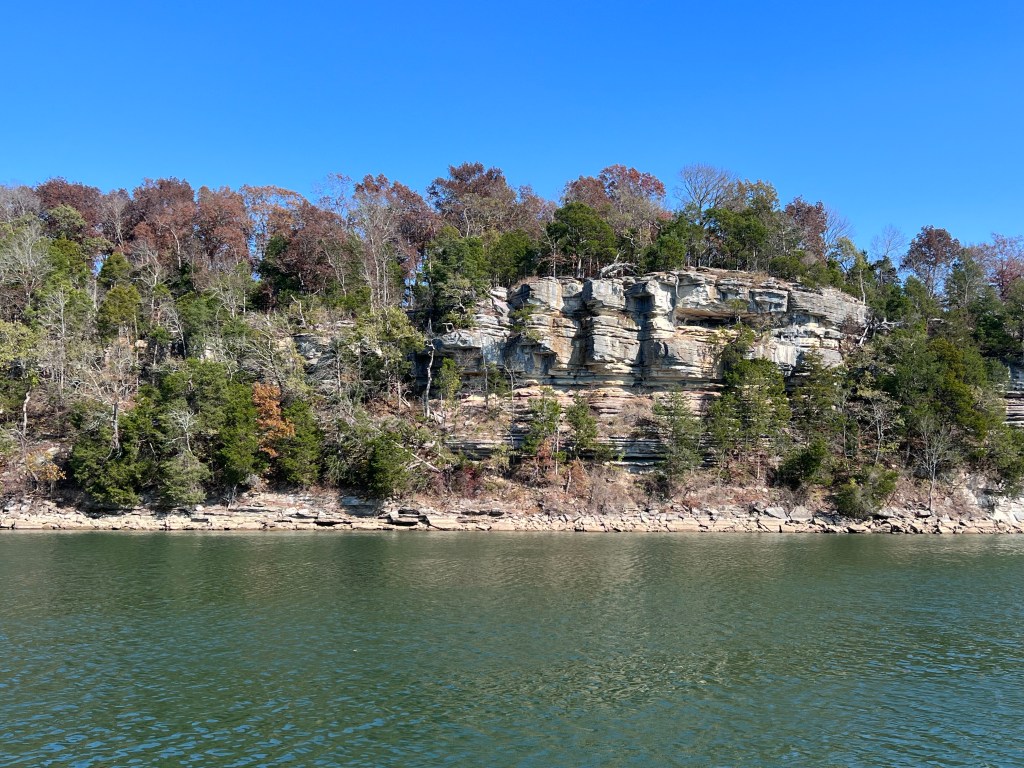
The landscape is pretty spectacular.
Libbie and I had a reservation at Pebble Isle Marina.
The marina is in an old tributary riverbed area that is gradually silting in.
At the water levels the Tennessee river is currently, we saw 6 feet of water going in.
When water is that shallow, we get nervous, particularly after our recent episode running aground.
There was a lot of muddy water stirred up from our propeller as we maneuvered around to our dock.
There were four other Looper boats, so we got together for Docktales and traded information about what we were going to experience the next few weeks.
The next morning we got up and continued up the Tennessee.
The higher up the Tennessee we went the stronger the current was against us. It was not as bad as the Ohio River, but it still slowed us down.
We started noticing what I call stilt barns.
These were interesting structures where folks had utility services installed on the top of the levees along the river.
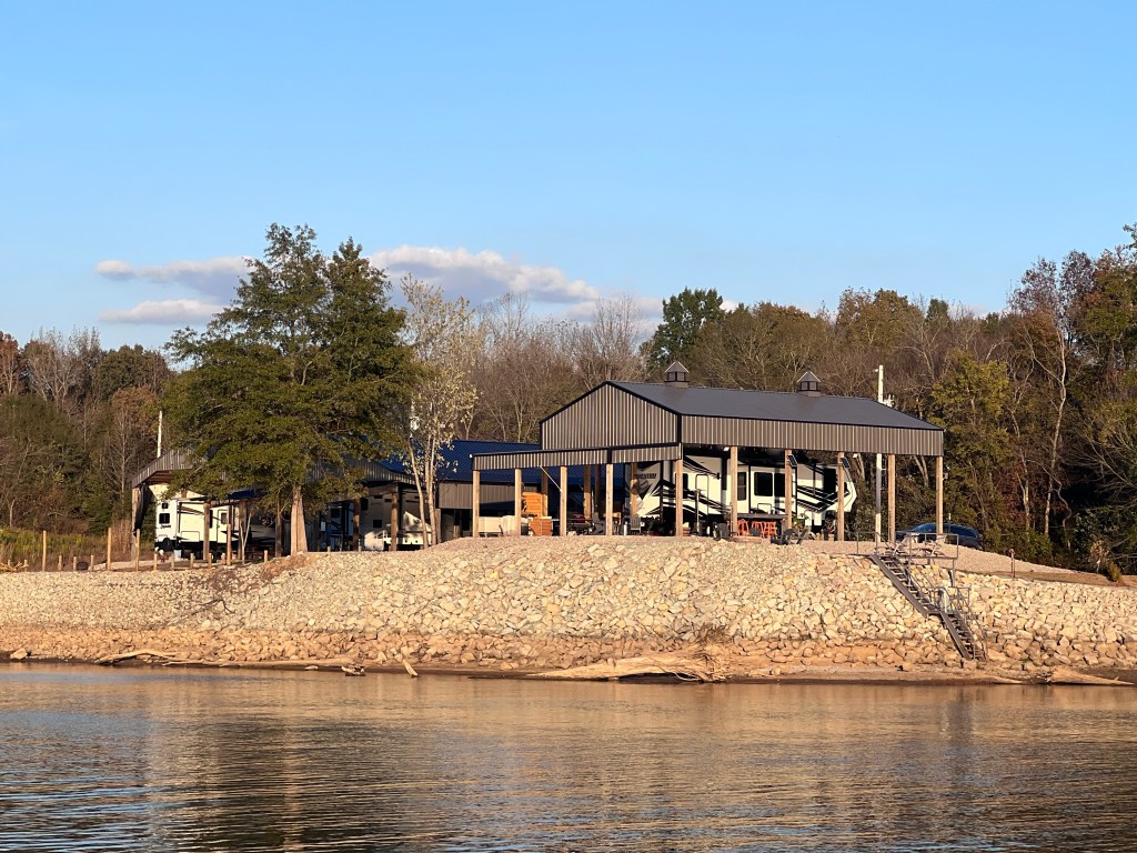
They parked their RVs under these structures. They were built for flooding, for when a flood came they could drive their RV’s away and their stilt barns would easily survive, ready for the next family holiday.
There were a lot of them.
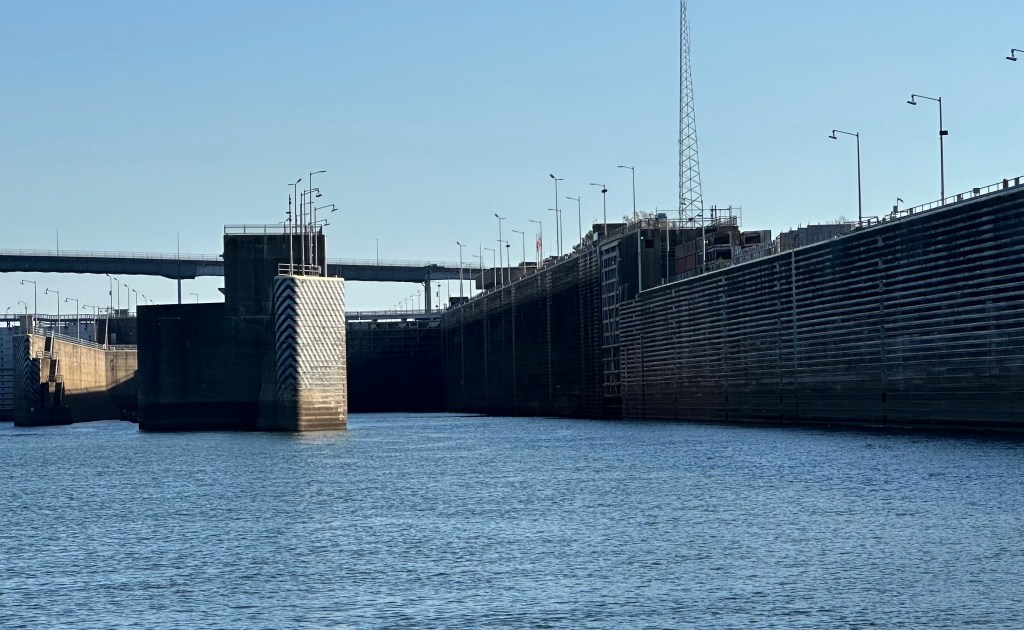
We anchored a couple of nights on the Tennessee before reaching the Pickwick Lock and Dam.
The morning we went through Pickwick block. I called the Lock Master, and let him know we were coming.
He gave me the instructions on how to come into the lock, and a witch pin to tie off to. he was very friendly and helpful.
The Lock Masters at Pickwick are famous for their Pickwick Lock Facebook page where they posts pictures of all the vessels commercial and otherwise that come through that lock.
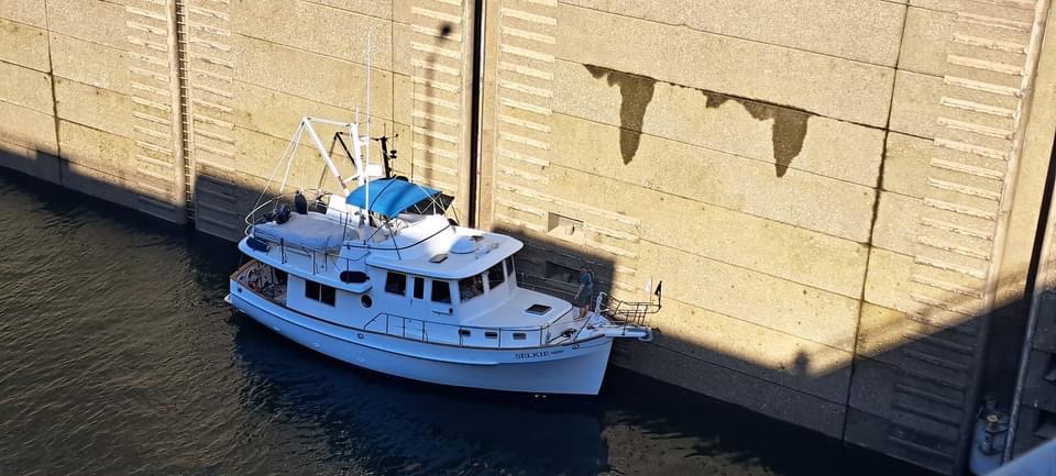
They even took pictures of Selkie coming through. You can get an idea of how big these locks are. Selkie’s thin radio mast is 30 plus feet high, to give you a sense of scale.
The page is an interesting page to follow if you’re interested at all in waterway navigation.

We locked through successfully.
We were then on Pickwick Lake, still part of the Tennessee watershed. It was an elevation increase in the Loch of probably about 60 or 70 feet.
We continued to another bay also called Panther Bay.
These Panther Bays must be named for the cougars that used to be native to the area back before they were mostly pushed out.
Sadly, we didn’t see any cougars, although there have been sightings as the big cats recover from being killed a century or two ago.
After we had anchored I had noted a couple of small, slender green buoys probably about 10 inches long and 3 inches in diameter.
I wondered what these strange bouys represented.
Could it be a favorite fishing spot?
Could it be a crawdad trap?
Could it be something else?
We got Selkie settled after anchoring.
I noticed that one buoy was actually moving. In fact it was moving a lot.
Some aquatic species was attached to the bottom of it.
Apparently some fisherman had gone after, some fish that take a while to catch, my guess is probably catfish. Whatever it was it seemed pretty big.
The bouy came close enough to the boat that it was tempting to grab it with a boat hook and see what was on the bottom.
When I got the boat hook out, it already moved away.
We watched that green buoy move all around our Anchorage all afternoon and pondered what it meant.
We were at our anchorage for a while when we noticed a boat coming in.
It turned out to be one of the boats that we met earlier on the Illinois river at the Ivy Club. They came over to us and greeted us.
We offered to them to raft up to us which they gladly accepted.
Rafting boats is when boats tie up at anchor. It’s called a raftup.
There are many ways to raftup, and there are lots of stories about things that happen to raftups.
There’s one story I like to tell about a raftup at Treasure Island with our old yacht club in San Francisco.
I always tell the story like a joke:
“What’s big and white and floats towards Emeryville?”
Ask me sometime and I’ll tell you the rest of the story.
We wound up having dinner together with our raftup friends and then had a rousing game of cards called Tens.
Libbie and I had never played the game before but of course Libbie won the first time.
We called it a night and went to bed.
The next day we were headed to a destination we were excited to stop at, Florence, Alabama.
Florence happens to be across the river from Muscle Shoals, a world famous town where the likes of Aretha Franklin, The Rolling Stones and other famous artists have recorded.
Our tour was scheduled, but we also had to get some chores done on Selkie, so we planned a stop there for three nights.
More later.

2 replies on “The Tennessee River”
So we never get to learn what was at the bottom of that slender, green buoy in the Tennessee River? Cliff hanger! Very much enjoying your blog Tad. What an amazing adventure. Your writing is awesome. Informational and engaging. Beautiful and informative(locking system) photos. What are your plans for the holidays? Is South Carolina an option? Hugs to Libbie and stay safe. Allison Taborek, Chapin, SC
LikeLike
Allison, we expect to be in SC in late April! We have several friends in the area , so will look you up.
LikeLike