Mississippi is a different animal then the Illinois river.
As we entered the Mississippi from the Illinois, we passed Grafton on the way and stopped at Alton.
We could not get into Grafton because it was the weekend of their annual Witches Festival.
Those who were able to dock at Grafton told us later that it’s is a great town, with no hardware store, no grocery store, but it has a bunch of bars. It seems that those who stayed had fun.
The witches apparently had fun too, all several hundred of them.
We spent three nights at Alton.
The first layover day was pretty much a werk day.
I did the 250 hour maintenance on the main engine.
Libbie cleaned Selkie nicely inside and out.
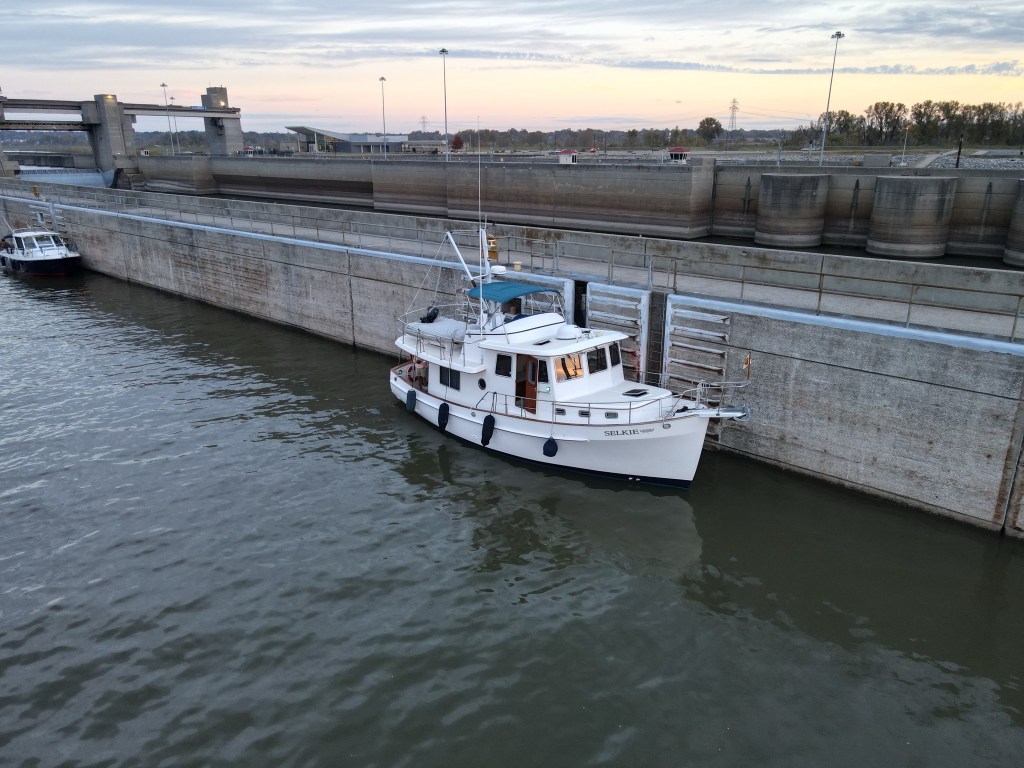
The next day we got on our bikes and went down to Lock 26, the Melvin Price Lock, a mile or so south of Alton.
It’s called Lock 26 because it’s the 26th Lock coming down the Mississippi from Minneapolis and St. Paul.
At the lock is the National Great Rivers Museum, which was a really fun stop.

It is not a big museum but it had a lot of information about the river that helped us plan our stops down the Mississippi. We didn’t need to do the full lock tour as we’re touring locks all the time on Selkie.
The museum has a towboat simulator that was fun. Libbie and I both wrecked some barges. Those towboat pilots have their hands full.

At the National Rivers Museum, one of the things we learned was that there’s all sorts of features called weirs, wing dams and chevrons that the Army of Corps of Engineers built in the Mississippi to help the water flow well and prevent the river from filling in with sediment.
These features minimize the amount of dredging to keep the Mississippi navigable.
These features also make anchoring possible in certain spots.
These features create large banks of sand bars and beaches along the way. On the river they are called bars whether above the water or below.
The ones above are beautiful beaches, mostly of sand, but sometimes the river rock depending upon the local geology.
In the Spring those beaches are mostly hidden.
When you see the bars, you can understand why people go out on boats and just drop anchor at a bar on the Mississippi and just hang for the day.
Some bars are much more remote than others. Many have huge logs looking like leviathan carnivores laying on top of the sand harkening back to the days when mammals did not rule the earth.
After the museum tour, we went back to Selke and had a nice evening making new friends at Docktales. We met with loopers all three nights at Alton to talk about going down to Mississippi and where to go.
One concern that we had is that a couple of the standard locations where Loopers stop overnight on the Mississippi were not available due to maintenance, dredging or low water.
Our first day running the Mississippi was going to be a 75 mile run with two locks early on before stopping by the Kaskaskia River entrance.
We wanted a good stop as these following days were going to be long days.
The Kaskaskia River has a lock just before the Mississippi,
Loopers like to stay there at the lock wall, or anchor below the dam that services the lock.
Unfortunately, the day we went down the Mississippi was the first day that the Kaskaskia lock wall and anchorage was not going to be available because there is a big dredging operation going on there.
That meant that Libbie and I had to find an alternate anchorage.
More later.
The first lock we locked through pretty quickly, but the second one we had to hold up for a tow to go through and that took about two hours.
Thankfully, the Mississippi River current allowed us to make up for lost time.
The Mississippi current was now going two to three knots of current down river. That meant with Selkie’s slow speed we could use that current to our benefit to put even more miles under our keel.
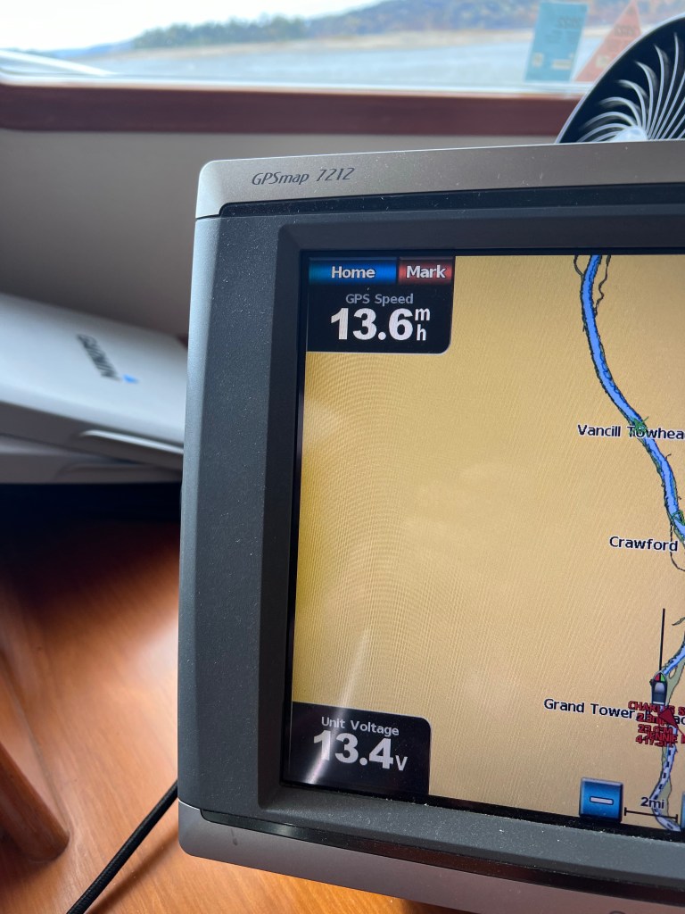
In fact I was able to document Selkie going almost 12 knots or 13.6 miles per hour on one section of the river.
That’s a land speed record for Selkie (at least under our ownership).
Maneuvering down the Mississippi is a little different than the Illinois river.
The Mississippi runs about five times as wide and about 3 to 4 times as fast.
You talk to the tugboats differently here as well on the Illinois.
On the Illinois, it was important to communicate with the towboats to make sure that we knew what they wanted us to do (hold, pass on the 1, pass on the 2, etc.)
On the Mississippi most of the time we don’t have to talk to the towboats because it’s obvious where we should go and the river gives more room.
The towboats really prefer not to hear from us unless there’s a problem.
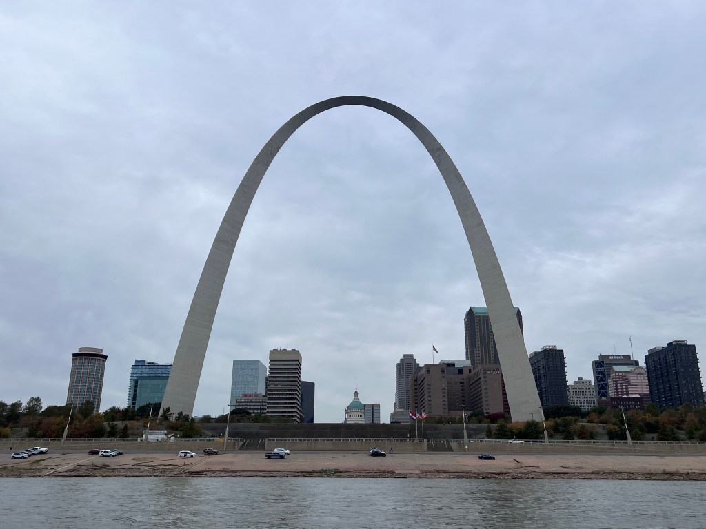
Passing through St. Louis we saw the Arch and was able to frame a couple pictures with the capital building underneath the arch.
The waterfront of St. Louis is not what I would resort friendly.
It’s full of barges and tugs and dredges and material.
It’s a lot of industry.
It’s not pretty to look at, but there’s a lot of commerce being generated and tax dollars revenue being generated. 60% of the grain in the United States from our farmers comes down the Mississippi.
Continuing on down the Mississippi, there’s high Bluffs with wealthy homes overlooking the river. On the opposite bank, it’s all marsh land and flood zone.

This flood zone is very important for managing the flood heights on the Mississippi. It allows the river to overflow in certain areas to contain the volume of water.
You can see where the water level consistently is 15 to 20 feet above where we are now when it’s spring time.
In the fall like we are now, it’s definitely low. There are some stains that are 20 to 25 feet and some eroded rock showing ancient floods, even taller than that.
One thing that’s interesting is that there are a lot of bald eagles around here.
We started noticing them on the Illinois river, but they’re everywhere. That speaks to good Eagle food sources of fish and carrion.
I had mentioned earlier that some work was being done to close a couple anchorages and tieups for Loopers.
With the Kaskaskia anchorage and wall closed, I called the Kaskaskia Lock Master for advice and he said to “just anchor between the wing dams.”
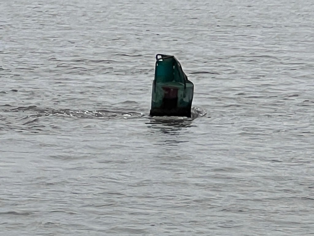
Wing dams are short structures that come out of the river bank to help control soil erosion.
They are out of the main channel, so provide a safe haven for boats to spend the night.
There are many candidate anchorages on the Mississippi that aren’t marked in any guide books. Most fit one or maybe two boats.
We anchored between two wing dams on the right descending bank of the Mississippi, just up from MM118.
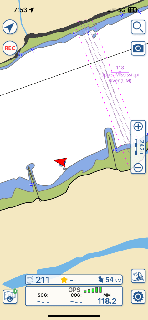
The sides of the river are described as descending banks. The right descending bank is on the right side of the river heading downstream.
We chose that spot because of winds forecasted coming out of the south gusting strongly at times. The river runs east at that point, providing shelter from the wind.
We always pay attention to the wind direction that’s forecasted when we anchor. We’ve seen some folks get in trouble pretty quickly when they don’t.
We anchored 2/3 of the way up current towards the western wing dam just inside in 15 feet of water and we swung into 10 feet. We had about 60 feet of anchor line out.
Following instructions my dad told me a long time ago, pick your spot, and approach from down current slowly crabbing your way in and watching your depth.
Watch for current changes as you tuck behind the wing dams. If you don’t pay attention, you can run aground.
If you don’t like a spot, just go to the next one.
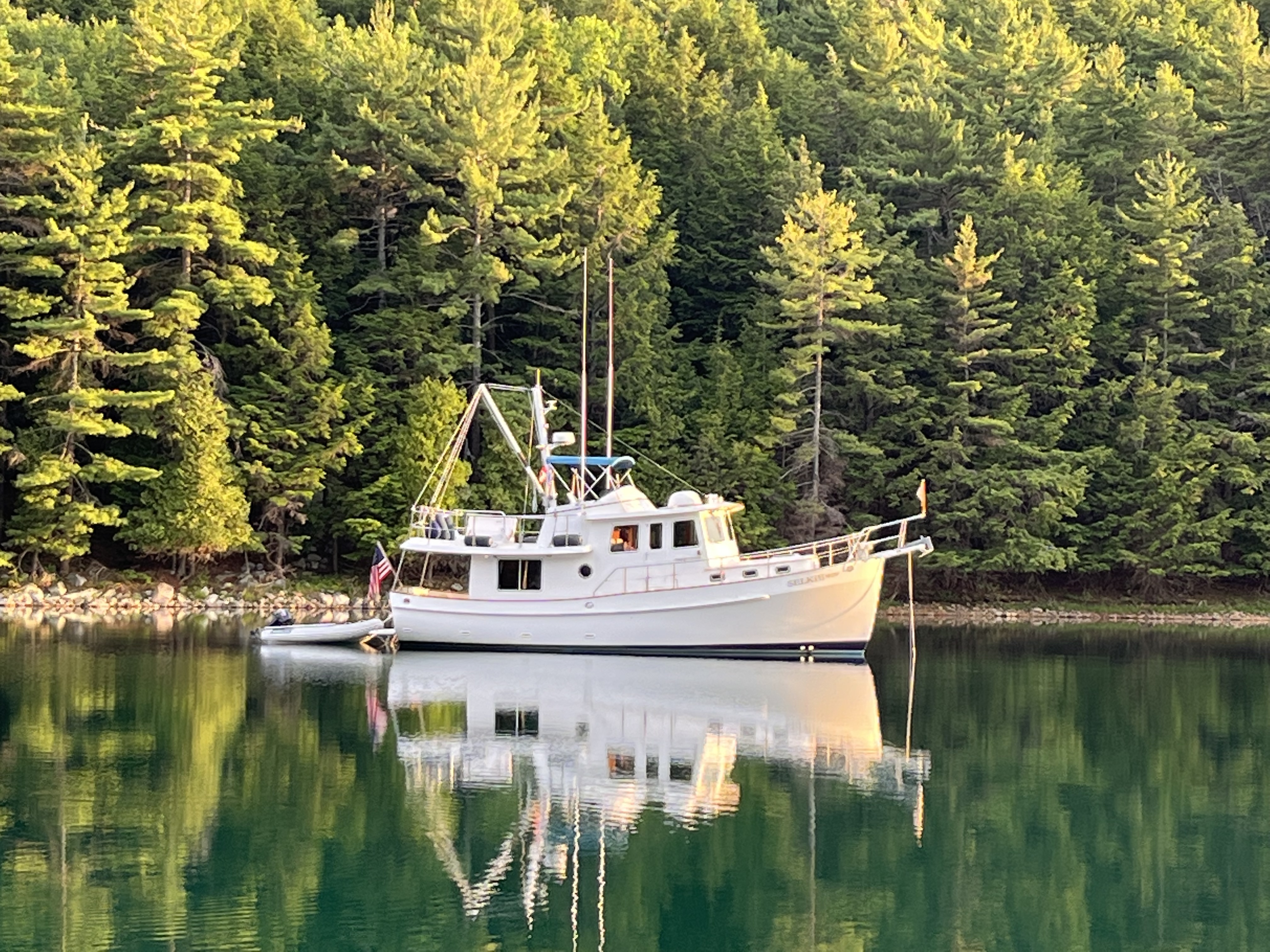
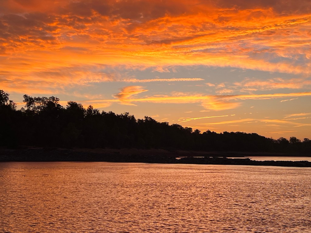
We’ve had some beautiful spots these past few nights.
On to the Ohio!
